Showing results 6341 to 6350 of 6572
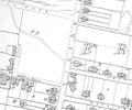
Extract from Ordnance Survey XL1V.10
Map
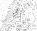
Extract from Ordnance Survey XL111.4
Map
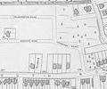
Extract from Ordnance Survey XL1V.10
Map
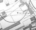
Extract from 1841 Plan
Map
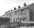
Museum Ref No: D_Baiter_Street_0019Victoria Terrace (off Baiter Street). Flat-bottomed boat in foreground. Photographer Barbara Bristowe.
Photograph
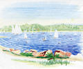
Museum Ref No: AH_View_from_Baiter_Park_to_BrownseaPostcard entitled "Brownsea Island". Colour drawing of view from Baiter Park to Brownsea.
From the Andrew Hawkes collection.
Picture
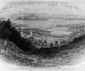
Museum Ref No: Coney album 3 photograph 109Drawing of view from Constitution Hill. Published by R. Sydenham. (From the Coney collection)
Picture
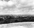
Museum Ref No: Bristowe2_108.A view from Constituition Hill looking towards Hamworthy. The School of Art & Technology, now Bournemouth and Poole Colledge, can be seen on the left with the Power Station in the background.
From the Ernest Bristowe collection.
Photograph
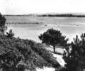
Museum Ref No: Bristowe2_107.A view from Evening Hill looking towards the Sandbanks Peninsula and Brownsea Island.
From the Ernest Bristowe collection.
Photograph
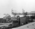
Museum Ref No: F1b_0007View from top of Rodney Court flats across to Quay, showing coal transporter and part of gas works (engineering shop) and sewerage pumping station.
Photograph