Showing results 4011 to 4020 of 6433
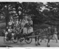
Museum Ref No: AH_PoolePark/PooleCarnivalPostcard of a float from an event in Poole Park, Photographer F Mitchell, Lester Road, Longfleet, Poole.
Photograph
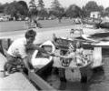
Museum Ref No: B6a_103Children on a pedalo on Poole Park Lake.
Photograph
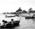
Museum Ref No: B6a_0140Children in Pedalos on saltwater lake, Poole Park.
Photograph
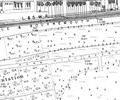
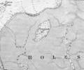
Extract from Ordnance Survey XL1V.10
Map
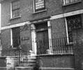
Museum Ref No: D_West_Street_0038West Street, No.11. Poplar House. Offices of the Hants and Dorset Mineral Water Co. House originally built by Richard Penney c.1795.
Photograph
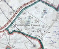
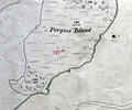
Museum Ref No: VM_XXXV13_PenningtonCovertPennington Covert, W side of Arrowsmith Rd below Brake Hills.
Detail of Ordnance Survey Dorset Sheet XXXV.13 scale 1:2500 1900 revision with valuation annotations AC
Map
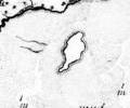
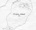
Museum Ref No: rVM_XLIII.12_PerginsIslandPergins Island, Holes Bay
Detail of Ordnance Survey Dorset Sheet XL.III.12 scale 1:2500 1900 revision with annotations. AC
Map
1785 survey, Mackenzie. Chart of Pergins Island
Map
1849 chart, Sheringham. Pergins Island
Map