Showing results 651 to 660 of 747
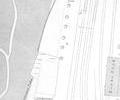
Extract from Ordnance Survey 16.5
Map
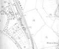
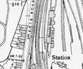
Extract from Ordnance Survey XL111.12 1902
Map
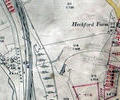
Museum Ref No: rVM_XLIII.12_SterteLodgeHeckfordFmSterte Lodge and Heckford Farm.
Detail of Ordnance Survey Dorset Sheet XL.III.12 scale 1:2500 1900 revision with valuation annotations. AC
Map
Museum Ref No: C_Sterte_0015Sterte; 5-15 Sterte Road. Rear elevations.
Photograph
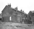
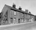
Museum Ref No: C_Sterte_0014Sterte; 5-15 Sterte Road. Front elevations.
Photograph
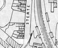
Extract from Ordnance Survey XL111.16
Map
Extract from Borough Engineer's Plan 1952
Map
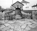
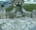
Museum Ref No: C_Sterte_0011Sterte; Fountain erected in 1950s on site of old spring.
Photograph
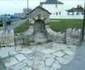
Museum Ref No: C_Sterte_0008Sterte; front view of modern stonework on site of old spring
Photograph
Museum Ref No: C_Sterte_0007Sterte; front view of modern stonework on site of old spring.
Photograph