Showing results 521 to 530 of 6433
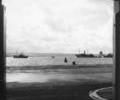
Museum Ref No: G10_0001Blockships in Poole Harbour ready to block the German invasion, 1940, viewed through an archway on the Quay across main channel. Isle of Purbeck visible in the middle distance; buoy.
From the Ernest Bristowe collection.
Photograph
Museum Ref No: D_Blue_Boar_Lane_0004Blue Boar Lane, derelict. Looking from Quay. Central drain. Photograph by Barbara Bristowe.
Photograph
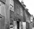
Museum Ref No: D_Blue_Boar_Lane_0005Blue Boar Lane, No.16, derelict. Bracket lamp. Photograph by Barbara Bristowe.
Photograph
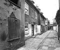
Museum Ref No: D_Blue_Boar_Lane_0001Blue Boar Lane, derelict. Looking towards Quay. Bracket lamp to right. Central drain. Photograph by Barbara Bristowe.
Photograph
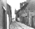
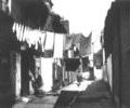
Museum Ref No: D_Blue_Boar_Lane_0002Blue Boar Lane, 1957. Looking away from the Quay. Washing lines across Lane. Central drain.
Photograph
Extract from 1841 Plan
Map
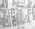
Extract from Ordnance Survey 16.14
Map
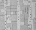
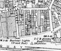
Extract from Ordnance Survey XL111.16
Map
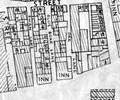
Extract from Ordnance Survey XL111.16
Map
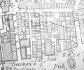
Extract from Borough Engineer's Plan 1952
Map