Showing results 5761 to 5770 of 6433
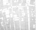
Extract from Ordnance Survey 16.14
Map
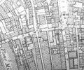
Extract from Ordnance Survey XL111.16
Map
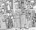
Extract from Ordnance Survey XL111.16
Map
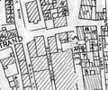
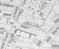
Extract from Borough Engineer's Plan 1952
Map
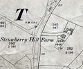
Museum Ref No: VM_XLIV>9_StrawberryHlFarmStrawberry Hill Farm, E of Ringwood Rd above Sweet Home Inn.
Detail of Ordnance Survey Dorset sheet XLIV.9 scale 1:2500 1900 revision with valuation annotations AC
Map
Street index to historical maps and charts of the Poole area.
Map
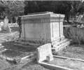
Museum Ref No: BEAM_0073Styring family tomb, Garland Cemetery.
Undated.
B/W photograph.
JPBC
Photograph
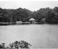
Museum Ref No: AH_SummerhouseFrom the Andrew Hawkes collection.
For commercial use please contact Andrew Hawkes by email: hawkes99@gmail.com
Photograph
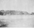
Museum Ref No: AH_Summer_House_BrownseaFrom the Andrew Hawkes collection.
For commercial use please contact Andrew Hawkes by email: hawkes99@gmail.com
Photograph
Extract from Ordnance Survey XL1V.10
Map