Showing results 1511 to 1520 of 2394
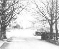
Museum Ref No: C_Parkstone_0117Lower Parkstone. Bottom right picture in set of four.
Photograph
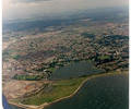
Museum Ref No: K1 19916_10 jpgAerial photo of Lychett Bay. Copyright holder Kitchenham Photography Ltd. Please refer to copyright holder for commercial use. J.D.
Photograph
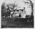
Museum Ref No: C_Hamworthy_0028Old Manor House, Hamworthy. 1873.
Photograph
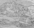
Museum Ref No: AH_Map_of_Brownsea_IslandSection of map showing Brownsea Island.
From the Andrew Hawkes collection. For commercial use please contact Andrew Hawkes by email: hawkes99@gmail.com
Map
Museum Ref No: PLA 942.337History of the Borough and County of the Town of Poole by H. P. Smith, Poole, J. Looker Ltd., vol. 1 1948. Illus. Page 8.
Book
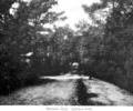
Museum Ref No: C_CanfordCliffs_0016Martello Road, Canford Cliffs.
Photograph
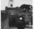
Museum Ref No: AH_Mary_Bonham_Christie_in_front_of_ClocktowerPrint of Mary Bonham Christie in front of the Brownsea Castle clocktower.
From the Andrew Hawkes collection. For commercial use please contact Andrew Hawkes by email: hawkes99@gmail.com
Photograph
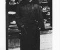
Museum Ref No: AH_Mary_Bonham_Christie_Owner_of_BrownseaPrint of Mary Bonham Christie, the former owner of Brownsea Island.
From the Andrew Hawkes collection. For commercial use please contact Andrew Hawkes by email: hawkes99@gmail.com
Photograph
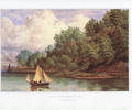
Museum Ref No: AH_Meryland_Brownsea_IslandPrint of a painting entitled Maryland Brownsea Island, by Philip Brannon, 1856.
From the Andrew Hawkes collection. For commercial use please contact Andrew Hawkes by email: hawkes99@gmail.com
Picture
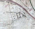
Museum Ref No: rVM_XXXIV12_ MerleyHallFarmMerley Hall Farm, Dawson's Hole and Northern edge of Municipal boundary.
Detail of Ordnance Survey Dorset Sheet XXXIV.12, 1:2500 scale, 1900 revision with valuation annotations AC
Map