Jump to Navigation
Poole Museum
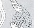
Round Island
Search
All records >
Places
>
By Location
>
Districts
>
Harbour
>
Islands
>
Round Island
>
Search within these records:
Keywords
Record type
all record types
Archive
Audio video
Book
Database
Document
Factfile
Map
Newspaper
Photograph
Picture
Weblink
A
|
B
|
C
|
D
|
E
|
F
|
G
|
H
|
I
|
J
|
K
|
L
|
M
|
N
|
O
|
P
|
Q
|
R
|
S
|
T
|
U
|
V
|
W
|
X
|
Y
|
Z
|
Showing results 1 to 10 of 10
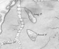
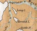
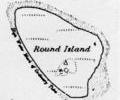
Long Island and Round Island, 1933 map
1933 O.S. map
Map
1 attachment
Round Island
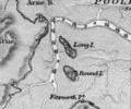
Round Island and Long Island, 1849 chart
1849 chart, Sheringham
Map
1 attachment
Round Island
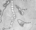
Round Island and Long Island, 1893 chart
1893 chart, Wharton
Map
1 attachment
Round Island
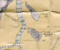
Round Island and Long Island, 1902 chart
1902 Admiralty survey, Sheringham
Map
1 attachment
Round Island
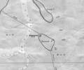
Round Island and Long Island, 1934 chart
1934 chart, Jones
Map
1 attachment
Round Island
Round Island and Long Island, 1935 chart
1935 chart, Stanford
Map
1 attachment
Round Island
Round Island and Long Island, 1947 chart
1947 chart, Courtney
Map
1 attachment
Round Island
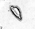
Round Island, 1785 chart
1785 survey, Mackenzie. Chart of Round Island
Map
1 attachment
Round Island
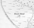
Round Island, 1890 map
1890 O.S map
Map
1 attachment
Round Island
Round Island, 1925 map
1925 O.S. map
Map
1 attachment
Round Island
Main menu
home
about this site
news
links
submit info
contact us
asas
topics
trade and industry
transport
maritime
people
people finder
society
places
by location
by subject
events
by date
by type