Poole History Online is a free online database of photographs, documents and data relating to the local history of the Borough of Poole. This website is managed by Poole Museum and updated by staff and volunteers. Find out more
about this site.
If you experience any problems, please see the
help page.
Showing results 1011 to 1020 of 10844
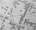
Extract from 1841 Plan
Map
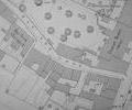
Extract from Ordnance Survey - 16.14
Map
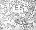
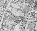
Extract from Ordnance Survey XL111.16
Map
Extract from Ordnance Survey XL111.16
Map
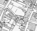
Extract from Borough Engineer's Plan 1952
Map
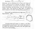
Museum Ref No: S 469Oyster licence for Francis Baynes, 1821
Document
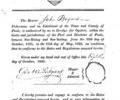
Museum Ref No: S 468Oyster Licence for John Baynes, October 1821
Document
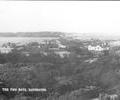
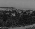
Museum Ref No: C_Sandbanks_0143The Two Bays, Sandbanks.
Photograph
Museum Ref No: C_Sandbanks_0098The Two Bays, Sandbanks.
Photograph
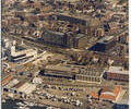
Aerial photo of BDH And West Quay Marina. Copyright holder Kitchenham Photography Ltd. Please refer to copyright holder for commercial use. J.D.
Photograph