Showing results 5711 to 5720 of 6433
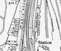
Extract from Ordnance Survey XL111.16
Map
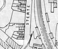
Extract from Borough Engineer's Plan 1952
Map
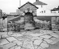
Museum Ref No: C_Sterte_0011Sterte; Fountain erected in 1950s on site of old spring.
Photograph
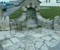
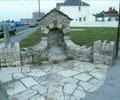
Museum Ref No: C_Sterte_0008Sterte; front view of modern stonework on site of old spring
Photograph
Museum Ref No: C_Sterte_0007Sterte; front view of modern stonework on site of old spring.
Photograph
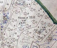
Museum Ref No: VM_XXXV.13StoatsHillStoats Hill, between Brake Hills and Canford Sports Arena
Detail of Ordnance Survey Dorset Sheet XXXV.13 scale 1:2500 1900 revision with Valuation annotations AC
Map
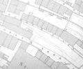
Extract from Ordnance Survey 16.15
Map
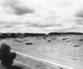
Museum Ref No: Bristowe2_88Stokes Bay and Brownsea Island from Shore road 1954.
From the Ernest Bristowe collection.
Photograph
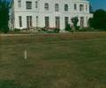
Museum Ref No: E1_0003Stone House, Wimborne. Home of the Garland family. White palladian mansion house. Façade looking west across lawn. Colour
Photograph