Showing results 141 to 150 of 1873
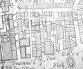
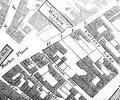
Extract from Ordnance Survey XL111.16
Map
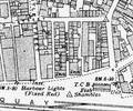
Extract from Ordnance Survey XL111.16
Map
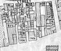
Extract from Borough Engineer's Plan 1952
Map
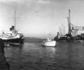
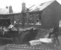
Museum Ref No: Bristowe 2_260Boat travelling between Quays, towards Poole Bridge. Boats moored Poole and Hamworthy Quays.
From the Ernest Bristowe collection.
Photograph
Museum Ref No: D_Lagland_Street_0003Lagland Street Infants' School (Rattray's) with bomb crater created by German bomber (21.8.1940).
Photograph
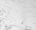
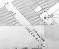
Extract from Ordnance Survey XL1V.10
Map
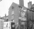
Museum Ref No: D_Bowling_Green_Alley_0001Bowling Green Alley. Premises and delivery van of Piper's Goodies (cooked meats and pies). Photograph by Stanley Swain.
Photograph
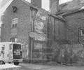
Museum Ref No: D_Bowling_Green_Alley_0002Bowling Green Alley. Premises and delivery van of Piper's Goodies (cooked meats and pies). Photograph by Stanley Swain.
Photograph
Extract from 1841 Plan
Map
Extract from Ordnance Survey 16.9
Map